16 Sep 2018 | 05:00am IST
Violations... with a bit of official help obviously
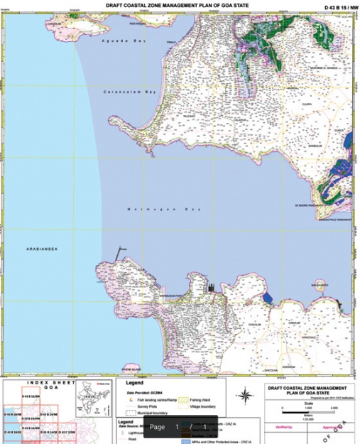
Last week, Herald exposed the draft Coastal Zone Management Plan (CZMP) which was prepared in May 2017 yet hidden from High Court and the people of Goa despite being selectively revealed to few Legislators and Ministers and event sent for amendments without any public consultation. Avinash Tavares digs deeper and reviews the document and reveals why the government hid the Plan even from the High Court and does not want Goans to know about it
he government’s High Tide Line doesn’t obey the moon but only what commercial interests dictate,” said an activist named Nityanand Jayaraman when commenting on the Tamil Nadu CZMP. It’s no surprise that the Goa government too has allowed commercial interests to dictate the HTL and the rest of the CZMP instead of listening to the real stakeholders which are the traditional coastal communities.
This is not the first time such a thing has happened in Goa. The Regional Plan was reduced to a zone conversion plan where commercial interests gained an upper hand over scientific spatial planning. The CZMP too has been reduced to the demarcation of HTL which will either block or open up lakhs of square meters of prime beachfront property for development.
protecting the CRZ Violators?
There is a consensus that the dwellings of traditional fishing communities within the CRZ need to be protected. The CZMP map will help identify all these dwellings. But there are many other structures that have come up in the CRZ area, particularly the commercial structures, which are claiming to be structures that existed before the CRZ Notification 2011.
According to the minutes of meeting of the National Coastal Zone Management Authority(NCZMA), in February 2016, it was reported that Goa was one of three states that were yet to submit information about CRZ violations and action taken report. They were also one of the many States that did not prepare the CZMP.
Needless to say, the GCZMA has not submitted a complete report on these violations and submit it to the NCZMA. This would also explain why the GCZMA had not prepared the CZMP. After all, the CZMP map would have exposed all the unauthorised structures within the CRZ area.
The GCZMA mislead the NCZMA
The GZMA are in the process of holding a public consultation on the draft CZMP and the plan will be finalised before 16th of October, said Sanjay Gihar the Secretary(Environment) to the NCZMA on 18/7/18 during the 34th meeting of the NCZMA.
We all know this is not true since the government has not even admitted publicly that the draft CZMP has been prepared.
High Tide Line caught between Politics Vs Ecology
The High Tide Line is the line to which the tide reaches the highest during spring tide. This line has to be drawn on the CZMP Map based on which the CRZ areas will be demarcated. The HTL is supposed to be demarcated scientifically but in Goa besides tidal influence, the exercise was also affected by political influence.
In the 32nd NCZMA meeting held in November 2017, the GoG informed that the HTL was submitted by NCSCM in March 2017. They further stated that “NCSCM made a presentation to the Hon'ble Chief Minister and GCZMA. The HTL prepared has been accepted with minor corrections. Field verification is planned with the officials of Government of Goa in November 2017.”
This short statement recorded in the Minutes of Meeting raises several questions. Why did the NCSCM make a presentation to the Government Ministers and what were the “minor corrections” done in the HTL? More importantly, why was the HTL plan not made public for consultation by the the stake holders such as traditional fishing community?
The Economics and Science of Demarcating HTL and LTL
This is the most critical aspect of the CZMP since hundreds of Crores are at stake. Even if the HTL is shifted to the west by even a single millimetre translates to 25 meters on the ground. Since the HTL has been sifted, the 200 meters (No Development Zone) line would also shift. This shift will unlock 25 meters length of land on the landward side.
If the property has a breath of 25 meters, the total area which opens up for real estate development is around 625 sqmts and will be at least 1.25 Crores worth (assuming Rs 20,000 per sqmt).
In the era of satellite imagery, it would be expected that the NCSCM would use satellite images of Goa’s Coastline to demarcate the highest point the sea rises during spring tide. However, the NCSCM appears to have limited the use of satellite imagery to identification of morphological structures and for planning field investigations.
Infact, the NCSCM has demarcated the HTL almost entirely on morphological structures such as berm crest of beaches, coastal dunes, vegetation line etc.
Interestingly even seawalls and barrages/locks and bunds are taken as the limit of tidal influences. Bunds are small dams that allow water to enter during high tide and are closed during low tide. Therefore, the tidal influence of Bunds go far beyond the bund itself. The question therefore arises is why is the NCSCM and the GCZMA limiting the tidal influence to bunds and not beyond the bund?
Another question that arises is why is seawall considered as the limit of HTL? Keri beach, for example, has a seawall but just like Puducherry beach, the beach can be restored. Could there be a conspiracy behind the construction of seawalls on beaches like Keri in order to move the HTL seaward and therefore prevent valuable real estate from coming under CRZ area?
The Draft CZMP needs to go back to the drawing board
According to the Draft Goa CZMP document, the primary purpose of a CZMP is to describe proposed actions to be implemented by administrative or other public authorities and potentially by private sector to address priority management issues in the coastal zone over a defined implementation period. These issues include
l Ensuring Livelihood Security to fisher communities and other coastal communities
l Conserving and protecting coastal stretches, its unique environment and its marine area
l Promoting sustainable development
Unfortunately, the Draft CZMP falls short on all there issues.
Draft Does not Ensure Livelyhood Security of Fishing Communities
The Draft CZMP states that there are 186 fishing wards falling within or adjacent to the CRZ area where the fishing activities are carried out in the State. However, their draft doesn’t mention the names of the wards/villages.
The Draft Plan and the Map cleverly restrict the fishing communities to the ward level instead. The CRZ Notification states that the Government of Goa shall notify the fishing villages. Why did the NCSCM and GCZMA demarcate only certain wards of the village related to fishing communities in the CZMP map instead of demarcating the fishing villages and what critieria did they use to declare these wards as fishing wards?
There is no information clearly identifying authorised construction within CRZ areas, present long-term housing plans for fisherfolk, identifying the hazard line and spelling out prospective plans for the CRZ area.
The only information remotely related to Fishing that is mentioned in the Draft is the details of registered Shrimp Farms, Major fish landing centers, Training walls, net mending shed, Fisheries department offices and few Jetties
Conserving and protecting coastal stretches, its unique environment and its marine area
Here too, the draft completely void of any conservation measures specific to Environmentally Sensitive Areas in Goa. For example, the report makes no mention of the biodiversity in Sancoal bay and the threat posed by barge building docks in the area.
Sanddunes are mentioned in the draft but there is no recommendation made to restore damaged sand dunes or create new sanddunes. Beach rejuvenation and creation of coastal forests also missing from the report.
Sand mining is mentioned in the draft but the NCSCM or the GCZMA did not find it necessary to recommend a reduction or increase in sand mining activities.
Promoting sustainable development
The draft does indeed promote tourism and other infrastructure development but whether or not they are sustainable has not been addressed in the Draft.
For example, Jetty terminals are proposed on the coast of Anjuna, Baga, Mandrem, Sinqueri, Miramar, Dona Paula, Baina, Majorda, Betalbatim, Colva, Canacona and Palolem. Besides the jetty, a fuel berth, waiting lounge, ticking services, and other services have been proposed at each of the sites. Canacona will also have parking for private yachts
If that’s not enough, the draft states that Colva Creek will also have adventure theme based development along with an entertainment park, public conveniences, children’s park, toilets, showers etc. The draft also proposes 40KLD sewerage treatment plant. All these facilities will also come up in Benaulim, Vagator, Fort Aguada, Calangute, Baga and Anjuna.
Besides this, details of Zuari Bridge, ongoing Canacona Bypass, Infrastructure development along the coastline by BTDC, GUDA and other departments are mentioned without any opinion of their importance or role in promoting sustainable development.
Other critical aspects the Draft fails to address
The Draft CZMP shies away from mentioning the specific threats to Goas Coast. The report makes no mention of MPT’s projects of deepening the channel and expanding the berths, all of which were proposed prior to May 2017.
The Draft does not inherent threats as well as man-made threats to specific areas along Goas. The issue of garbage pollution, excessive extraction of groundwater, salt water ingression, and also sewage discharge are missing from the plan.
The NCZMA had issued directions to all the States that the Hazard line must be reflected in the CZMP Plan. These directions have been ignored by NCSCM. The demarcating the Hazard line on the CZMP map is important since all future development and planning process in coastal areas have to take into account the hazard line. The directions were issued with a view to reduce vulnerabilities of the coastal communities, ensure sustainable livelihood and safeguard coastal areas.
The Draft is void of specific policy measures the State would need to adopt to conserve, protect and manage its coastline.
The cardinal sin made by the GCZMA while preparing the Draft CZMP is that they did not consult the real stakeholders, that is the traditional fishing community and coastal tribal community, before compiling the Draft. The Draft CZMP, therefore, lacks the framework necessary to address village or cluster-specific issues and threats to the coast and the stakeholders.
When the Draft is published for public scrutiny, there will surely be widespread opposition both from the fishing community and also local tourism stakeholders such as shacks and guest houses which operate in unauthorised structures within CRZ areas.
--
What is Coastal Management and CZMP
Coastal management is defined as ‘the protection, conservation, rehabilitation, management and ecologically sustainable development of the coastal zone. Coastal Zone Management deals with the best management practices adopted to address the key issues of coastal resources. The basic purpose of coastal management is to discuss and review a set of physicochemical parameters for coastal management mainly in terms of eutrophication and to illustrate how the bio-indicators related to one another and express fundamental structural and functional properties of coastal ecosystems. The question is how this integration is possible and how it can be best achieved. The present investigation represents the results of the integration of disciplines and it deals with the questions required in order to achieve a sustainable development. The final goal was to develop a system for the integrated analysis of the economic, biological, hydro-geological, ecological and human dimensions of coastal use. new maps might be more influenced by commercial interests eyeing coastal development than environmental considerations.
Need for CZEMP (Coastal Zone Environmental Management Plan)
The coastal areas are assuming greater importance in recent years, owing to increasing human population, urbanization and accelerated developmental activities. These anthropogenic activities have put tremendous pressure on the fragile coastal environment. In all the coastal states of India, coastal zone management has got growing importance. The reasons for the importance of coastal zones are the density of people residing in the coastal zone is high and increasing and conflicts between coastal communities are obvious. Conflicts among user groups competing for space are becoming more and more common.
The Coastal zone is strategically important from environmental, economic and social points of view. Therefore, solving and mitigating some of its problems is of vital consideration when shaping the policy for sustainable development and needs integrated and co-ordinated management policies.