PANJIM: In what can be called as a major achievement for the CSIR–NIO, the organization has found that Dholavira, in Gujarat, could have been destroyed by a tsunami.
Dholavira in Gujarat was a site of an ancient metropolitan town of the Harappan period. Dholavira was the largest port-town of the Harappans, and is the second largest Harappan site located within the present borders of India.
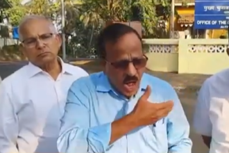
“This well-planned urban settlement flourished for about 1500 years from about 5000 BC to 3450 BC before present archaeological excavations show that the township comprised three parts of the castle, the middle town, and the lower town,” said Dr SWA Naqvi, Director, CSIR – National Institute of Oceanography (NIO).
He said that a unique feature of Dholavira is the presence of a 14-18 metres thick wall, apparently built as a protective measure.
Intriguingly, Dr Naqvi added, walls of such thickness are not found even in historic times when the conflicts have been more common and
the weapons have become increasingly more destructive.
“Therefore, the real purpose of the Dholavira wall has been a topic of considerable debate,” he said.
Another scientist, Dr. Rajiv Nigam in a presentation said that recently a group of scientists deputed by Dr SWA Naqvi, Director, CSIR–National Institute of Oceanography (NIO), Goa and led by himself, had proposed that the thick wall was built to protect the
town from extreme oceanic events such as storm surges and tsunamis.
“CSIR-NIO has carried out additional work at this site. A team of palaeoclimatologists, archaeologists and geophysicists from the Institute surveyed a hitherto unexcavated area using Ground Penetrating Radar and systematically collected soil samples,” he
said.
Dr Nigam said that the GPR records show 2.5 – 3.5 meters thick homogenous soil layer (without any layering) below the surface, which suggests its episodic deposition, possible due to an extreme event. He said with the permission of the Archaeological Survey of India (ASI) a 2.5m x 2.5 m trench was dug in the north western corner of the Middle Town to a depth of 3.65 m.
“Fresh vertical section of the homogeneous soil thus exposed was sampled at regular intervals to infer the depositional history.The soil samples have been found to contain fossils of ‘foraminifera’ microscopic organisms that builds calcareous shells and live only in
seawater,” he said adding “this presence of shells of marine organisms in the soil strongly suggests and episodic deposition of marine sediments in the area, which could have occurred as a result of a massive tsunami.”
Dr Nigam said Tsunamis are known to have hit the region during the historical period.
“For example, the Makran Earthquake of 28th November 1945 generated a huge tsunami, over 10 meters in height that devastated large areas along the northern shores of the Arabian Sea,” he said.
However, Dr Nigam stated, the exact timing of the sediments deposited in Dholavira is yet to be established. However, he added, the results clearly indicate that massive tsunamis are not uncommon in the region.
“The thick wall in Dholavira shows that Harappans were not only aware of the potential threats from tsunamis, but they were also pioneers in coastal disaster management. Most importantly, results of this study opens be possibly that Dholavira, at least in part, could have been destroyed by such a tsunami.”
The CSIR–NIO team comprised of Dr. V.J. Loveson, Dr. A.S. Gaur, Sundaresh, S.N. Bandodkar, Ryan Luis, Gurudas Tirodkar and. Rupal Dubey.