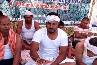
A huge mound of white sand outside a private residence was puzzling. Since last few months, a similar situation at many places that this author observed was equally baffling. A close look at the colour, type and texture of sand confirmed that the white sand was removed from beach areas, and not from the rivers. Obviously diverted for construction activities, beach sand is being plundered by unscrupulous elements. The existence of sand mafia in Goa is well known. Despite the pandemic, building activity is in full swing, and although the ban on sand extraction is in force, the pilferage continues.
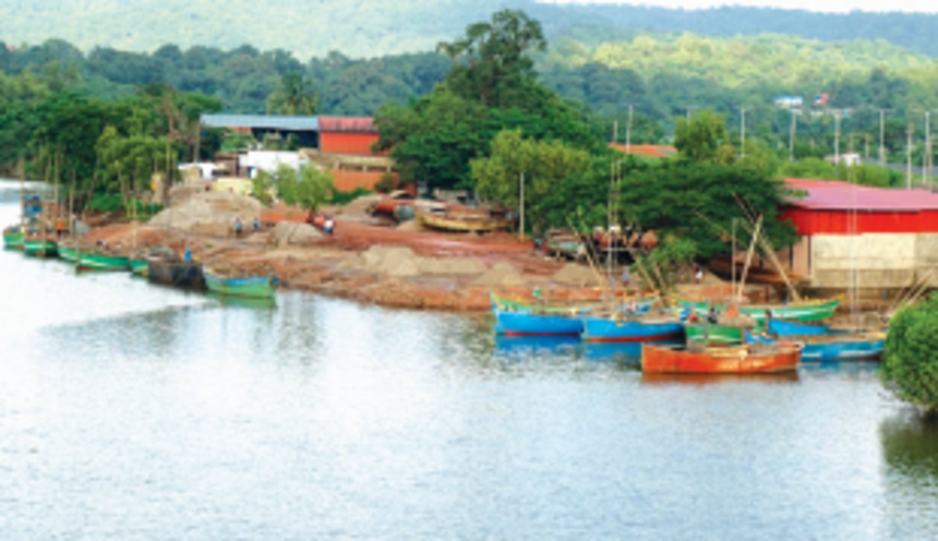
The environments of sand deposition in rivers of Goa depend on the geological setting of the area. Based on field data, several sites with significant sand content can be identified: (1) Sand spits at river mouths: The estuaries of rivers Tiracol, Chapora, Sal, Talpona and Galgibaga are characterised by large accumulations of sand in the form of elongated spits, features that result due to littoral currents. (2) Sand shoals within estuaries: Prominent sand bodies that sometimes get exposed at low tide are noted at Chapora in particular, Sal, Talpona, Galgibaga and Maxem. Near shore areas of Aguada and Dona Paula are also dominated by sand. Such coarse sediment is brought by rivers, dumped at the mouths, and redistributed by marine action. (3) Sand around islands within rivers: Composed of appreciable sandy sediment, several islands have increased in dimension over decades. Google Earth images reveal 5 in Tiracol, 6 in Chapora, 4 in Mandovi, 1 in Zuari, 3 in Sal and 1 in Talpona. The one off the old ferry point at Siolim is an example of a stabilised the island. (4) Sand deposits along river beds: Major environments of deposition and accretion of sand are observed along the axis/central parts of the riverbeds. The sediment load transported and brought down from the hinterland by high intensity flow during monsoon is responsible for these accumulations. (5) Gravel and pebbles in rivers: These deposits are noted in the narrower rivers in the rocky regions of the hinterland. Continuous erosion of rock outcrops due to high energy river flow forms gravel; finer sand is however transported further downstream. (6) Sandy beaches and dunes: These settings are exclusively composed of loose sand. Although outside the purview of river systems, sand was being mined from the coastal dunes of South Goa around 30 years ago.
Where are the sites where sand abounds? What is the total volume of sand deposits within the river systems of Goa? Which sites can be mined without ecological damage? So as to get a correct assessment, specific geological investigations are needed. Some research aspects are briefly listed here: (A) Closely spaced sediment sampling using a grab, followed by laboratory analyses, will reveal the mineralogical and geochemical composition, and hence the sand, silt and clay content. (B) Echo sounding and sub-bottom profiling by employing an echo sounder and a profiler will confirm the depth of water, and also give a rough estimate of the thickness of loose sediment; a boat is needed for such a study. (C) Side scan sonar deploys a boat mounted side-looking underwater transducer that laterally scans the riverbed on either side of the moving boat; the tone as seen in the paper record can indicate if, for example, the riverbed has sediment or if it is rocky. (D) Based on the above results, coring in selected pre-confirmed sandy locations using a corer will calculate the thickness of sand, based on which the volume of deposits can be estimated.
Scientific data about sites where sand thrives, distribution of deposits, their thickness below riverbed, and total volume of sand within the river systems of Goa is not available. NIO scientists have published several papers dealing with rivers, but these address specific pointed issues only, and are of academic interest. A study dealing with sand deposits with special reference to sand mining was rarely attempted. Pending such studies, certain recommendations can be made, provided the ecological sensitivity is not disturbed: (a) Spits at river mouths trap sand and keep growing, thus creating navigational hazards. Initiatives are needed to restrict the spit growth. Here, excess sand may be mined, exclusively by manual methods, so that the spit is maintained up to a desired size. Sediment needs to be transported manually, dumped along damaged dunes or used judiciously. (b) Shoals within estuaries are a big concern at Chapora, Sal and Galgibaga. Fishing trawlers often run aground. These sites can be mined up to a minimum depth as required by trawlers to navigate out of the river. The surplus sand from the river can as well be used to nurture the beaches, or if in excess, can be used for other genuine purposes. (c) Islands in rivers are expanding as well. Sand flats around them can be mined so that their growth is controlled and water around them remains deep. (d) Central portion of rivers is where sand thrives due to regular sediment supply. It is here that sand extraction is rampant. The exact quantity of sand to be removed will remain unresolved pending scientific studies.
Sand mining is not an issue. Quartz sand is the most dominant mineral on earth. The major concern is the frenzied manner by which sand is ransacked from prohibited places. It now appears that coastal areas are being assaulted. The rivers of Goa are influenced by daily tides and hence governed by the CRZ rules. Mining of river sand is a regulated activity and hence needs a comprehensive scientific study or an EIA. In Goa, a science-based sand mining policy does not exist.
(Dr Antonio Mascarenhas is a former Scientist, NIO, Goa)