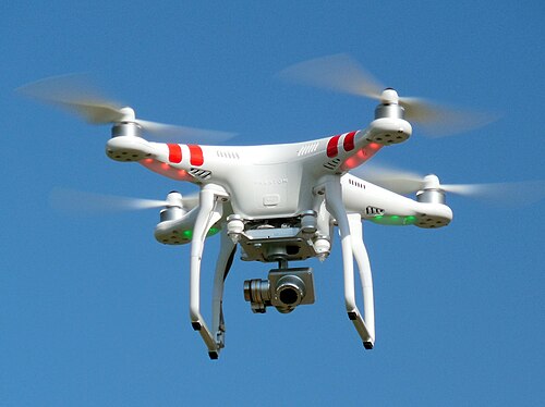
India is preparing to introduce a nationwide digital system to manage the growing number of drones operating at low altitudes, as the country moves towards wider use of unmanned aircraft for deliveries, agriculture, surveillance and other commercial applications.
The Airports Authority of India (AAI) is exploring a national Unmanned Aircraft Systems Traffic Management (UTM) system that would oversee drone traffic up to 1,000 feet above ground level. The initiative is aimed at creating a safer and more organised low-altitude airspace as drone operations become increasingly common.

CNN-News18 has accessed a document issued by AAI seeking global technical and operational inputs from companies capable of helping develop the proposed system. The exercise is intended to help the authority understand available technologies, assess the maturity of existing UTM solutions and determine an architecture and deployment model suited to India’s requirements.
The need for such a system has become more pressing as drones move beyond experimental and limited applications. They are already being used for surveillance, mapping, agricultural spraying and other activities. Commercial drone deliveries are expected to expand, while the possibility of using unmanned aircraft for transporting people could further increase the volume of low-altitude air traffic.
India’s existing Air Traffic Management infrastructure is primarily designed for conventional aircraft and is not intended to handle potentially thousands of small unmanned aircraft operating simultaneously at lower altitudes.
Integrating every drone directly into traditional air traffic control systems could also require costly and bulky equipment. AAI is therefore considering a largely software-driven and automated UTM framework that can monitor aircraft movements, exchange information in real time and issue alerts when potential safety problems emerge.
Three Key Safety Features
One of the proposed system’s important components is geofencing. This would help ensure that drones remain within their authorised operating areas and alert remote pilots when an aircraft approaches a designated boundary.
The second feature is real-time tracking, allowing authorised stakeholders to access information about the locations of manned and unmanned aircraft in a particular area. This would provide a more complete picture of activity in the airspace.
The third is No Permission, No Take-off (NPNT), building on India’s existing regulatory framework to prevent unauthorised drones from taking off and operating without the required permission.
The proposed UTM system would also include a conflict-management layer capable of identifying potential problems involving multiple drones, manned aircraft, obstacles, emergencies and other incidents.
If two unmanned aircraft were approaching potentially conflicting flight paths, for instance, the system could generate alerts. It is also expected to enable two-way, real-time communication between the UTM platform and remote pilots or unmanned aircraft.
The system is planned to integrate with DigitalSky, the government’s existing digital platform for regulating the drone ecosystem, as well as conventional Air Traffic Management systems.
The development marks a shift from simply regulating individual drone operations to managing increasingly crowded skies. As the number of authorised unmanned aircraft grows, authorities will need infrastructure capable of tracking their movements, identifying conflicts and coordinating operations.
AAI’s current exercise remains at an early stage. The responses received from technology providers will help the authority finalise requirements for a future Request for Proposal.
For India’s expanding drone industry, the proposed UTM system could become critical infrastructure, enabling commercial and autonomous operations to scale while maintaining aviation safety.