Team Herald
MARGAO: After getting no response to their pleas for building the Western Bypass stretch in Benaulim on stilts, the Cana-Benaulim village panchayat has approached the Goa bench of the Bombay High Court (HC) opposing the proposed construction of the bypass via embankments in the village.
The HC is already monitoring the Western Bypass work in Suo Moto Public Interest Litigation (PIL), and in this connection, the Benaulim panchayat has filed a Miscellaneous Civil Application that also contained a preliminary hydrology report conducted by an agency on behalf of the local body.
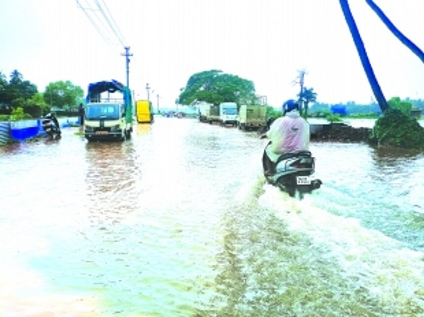
The panchayat argued that if the bypass is built by filling up the low-lying areas, it would cause flooding and pose a risk to life, property, and the livelihoods of local farmers.
The HC has fixed June 19, 2023, as the next date for the hearing and has asked the respondents, including the PWD, to file their responses by that date.
In their application, the Benaulim Sarpanch Xavier Pereira argued that while the HC had given directions to complete the bypass within the timelines, no attempt was made on the part of the authorities to bring on record the conditions at loco, which are faced by the villagers.
The panchayat also asked the HC not to permit the haphazard construction of the bypass and to keep the ongoing reclamation work on hold. The petitioner also asked the HC to direct the Chief Engineer of the Water Resources Department (WRD) to resubmit its report on the proposed bypass based on the recommendation of the Hydrologist the panchayat had consulted.
—
Hydrologist’s report tears apart WRD study,
government’s defence of bypass on embankments
MARGAO: The preliminary hydrology report submitted by an agency on behalf of the Benaulim village panchayat pointed out several shortcomings in the Water Resources Department’s (WRD) proposed Western Bypass ‘solution’.
According to the hydrologist’s report, the WRD’s study had insufficient base data and information, and the entire catchment area was not considered. The report also lacked ground survey, field measurements, sampling or demarcation of flood plain detention basis and traditional openings.
The hydrologist argued that the proposed elevated structure would cause water logging due to the damming effect and is thus a poor solution.
The methodology used to analyse the draining in the study area was rudimentary, and the WRD’s recommendations were vague and needed to be reworked with actual facts and figures, considering the right discharge points of Sal River at Khareband. The hydrologist concluded that if the figures are reworked, they will be much higher than those stated in the WRD’s report.