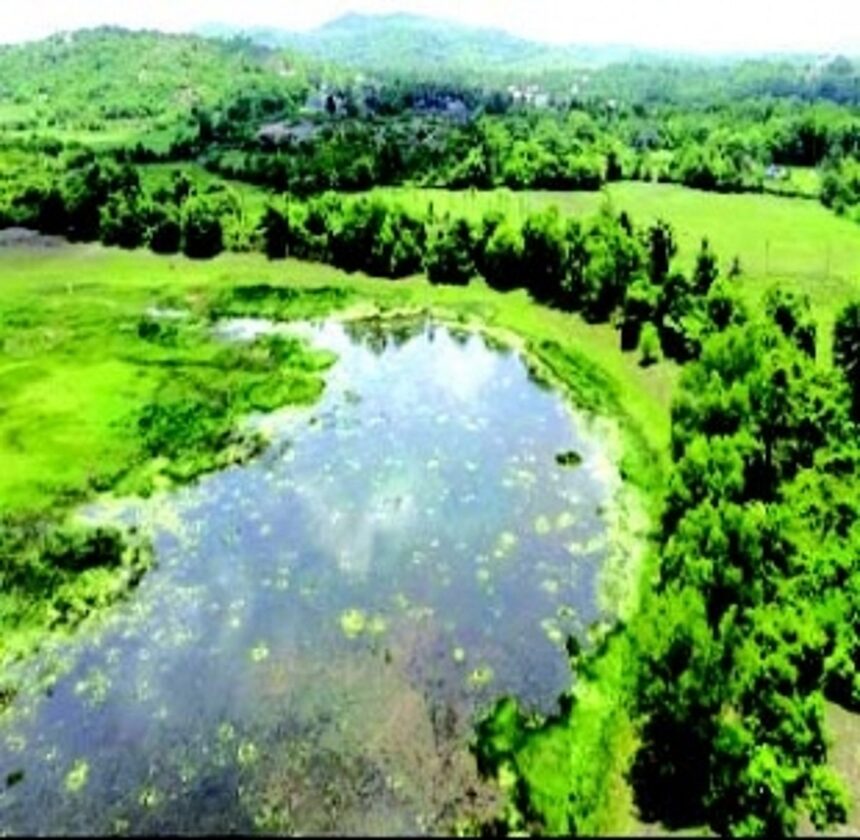
MARGAO: The recent notification declaring Lagoa de Cima, also known as Oilem Tollem, as a wetland has been warmly welcomed by its custodians—the comunidade of Cavorim, the Chandor-Cavorim Panchayat, and the Village Biodiversity Management Committee.
Notably, no objections have been raised, as the deadline for filing objections lapsed on November 25.
Cavorim comunidade President Charles da Silva, Attorney Luel Fernandes, former president and attorney Tiago da Silva, along with two shareholders, convened at the President’s residence promptly after the publication of the notification to express their approval.
Chandor-Cavorim Sarpanch Estefanio Dias said the panchayat was completely backing the proposal. “This beautiful lake has to be protected and preserved for the future generation,” he said.
The Chandor-Cavorim Biodiversity Management Committee, at its October 9 meeting, had earlier expressed their long-standing request for such a notification and subsequently decided to extend a written welcome to the Goa State Wetland Authority.
Committee Chairman J. D’Silva underscored the lake’s unspoiled beauty and stressed the importance of preventing its degradation through construction and unwarranted activities.According to Cavorim Communidade records, the lake is referred to as Lagoa de Cima or Vellem Tol, while villagers call it ‘Oilem Tollem’. It is worth noting that ‘Lagoa’ is the Portuguese term for lake, making the use of ‘Lagoa de Cima Lake’ in the notification redundant.
The nomenclature ‘Oilem Tollem’ holds historical significance. In the past, the sluice gate of the stormwater drain, known as Oll, was closed at a location called Hand near Miriajirem in Cavorim during August after the monsoons. The water collected in the present-day fields ahead of the sluice gates was previously termed ‘Dakhtem Tollem’. These fields are still referred to as ‘tolleant’. Since this seasonal lake was relatively small, the larger perennial lake was called Oilem Tollem, explained Tiago da Silva.
The draft notification designates an area of 1,56,688 sq mts as the wetland, with an additional 92,001 sq mts allocated as the buffer zone. The buffer zone extends 50 meters around the highest flood line of the proposed wetland and includes parts of 80 properties measuring 87,309 sq mts, along with an attached nullah spanning 4,692 sq mts.
Tiago da Silva lamented that the road leading from Gudi to Culsabhat in the village, once an embankment or ‘Xelle marog’ of the Dakhtem Tollem formed due to closing the sluice gates, has now been converted into a road, thereby eradicating the ancient form of irrigation that prevailed in their village.