Team Herald
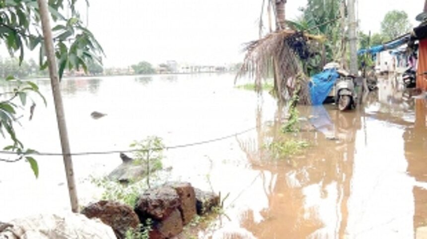
MARGAO: The Benaulim panchayat has taken its fight to the High Court to halt the construction of the Western Bypass on embankments through their village. They have voiced their concerns over the catastrophic damage the proposed construction would cause to the area and the livelihood of farmers.
Despite the panchayat’s repetitive pleas, the authorities have ignored them, prompting the panchayat to question why.
The panchayat has also stressed the importance of constructing the bypass stretch on stilts rather than embankments. They have highlighted the authorities’ insufficient and inadequate data to support the current proposal of filling up low-lying areas.
The hydrologist consulted by the panchayat pointed out the numerous faults in the study done by the Water Resources Department (WRD) that recommended constructing the bypass on embankments.
The hydrologist pointed out that the study did not mention the maximum and average height of floods, which is important in assessing the area currently impacted by flooding and determining the height of culverts. The study also did not consider the existing constrictions from the wholesale fish market to the southern boundary of Benaulim. “Constructing the highway along or close to narrow points in the river where the channel width decreases can have a significant impact on the flow of water and sediment transport, as well as the hydrology, ecology, and human activities within the river basin,” said the hydrologist.
The absence of a floodplain mapping report and flood modeling report were also highlighted. The formulae used by the WRD to predict peak discharge points were also limited, and the settlement areas near Khareband bridge, currently affected during floods, were not included in the study.
The hydrologist also pointed out that the peak flood discharge of 153 cumecs, based on the discharge near the wholesale fish market and not where flooding is known to occur, is vague and should have been worked on with real-time data.
The statement that “the river permits a flow of 76.25 Cumecs” is not backed by any theoretical or practical evidence, and the flow rate of the river should be accurate since a higher flow rate implies faster discharge and less flooding, whereas a lower flow rate indicates greater flooding.