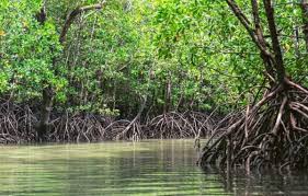
PANJIM: In a significant push to rein in unchecked riverbank development, the Goa Forest Department has identified 6,729.54 hectares of land along the Mandovi and Zuari rivers as ecologically sensitive, formally flagging the stretches for protection particularly against mangrove destruction.
The delineation, covering both riverbanks, has been submitted to the Town and Country Plan ning (TCP) Department, with authorities urging im mediate regulatory action to prevent further ecological degradation in these vulnerable zones.

“It is submitted that the Forest Department has undertaken the exercise of identification and de-lineation of ecologically vulnerable areas along the banks of the major rivers of Goa, namely the Mandovi and Zuari rivers. The total area identified along both riverbanks is 6,729.54 hectares (approximately 6.72 crore square metres).” the Deputy Conservator of Forests, Working Plan Division, stated in a communication to the Chief Town Planner.
The department has also enclosed detailed maps marking these ecologically vulnerable areas, seeking their integration into planning frameworks to ensure legal protection under ex isting TCP regulations. Calling for urgent intervention, the Forest Departmer has requested the TCP to initiate “necessary action as pe the extant TCP Act/Regulation/ Rules” to safeguard thes stretches-long under pressure from real estate expansion, infrastructure projects, and illegal land filling. The move signals a tightening of oversight along Goa key river systems, where mangroves critical for flood control, shoreline stability and biodiversity – have increasingly come under threat.