SHASHWAT GUPTA RAY
Despite years of Smart City works cost ing hundreds of crores and repeated assuranc es of improved urban infrastructure, Panjim continues to be Goa’s most flood-prone ur ban centre, exposing the limited impact of expen sive redevelopment pro jects on one of the city’s most persistent civic problems. A new study by the Government of Goa’s College of Multidisciplinary Studies and Re search (CMSR), Margao, which analysed 46 rainfall-induced ca lamities recorded across the State between 2017 and 2024, found that Panjim and its adjoining com mercial areas — including Patto, St Inez and 18th June Road — remain the most vulnerable to monsoon flooding.

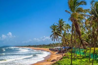
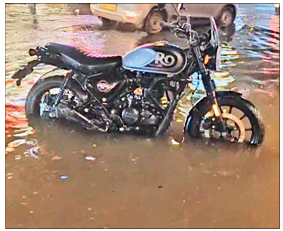
The findings come close on the heels of Sunday’s flooding, which once again brought large parts of Panjim to a standstill despite years of Smart City works. The inunda tion disrupted traffic, damaged businesses and inconvenienced residents, prompting Corporation of the City of Panaji (CCP) Mayor Rohit Monserrate to apologise to affected traders on Monday and assure them that inspection and repair work would begin to iden tify and rectify the cause of the waterlogging. “This study analyses 46 rain fall-induced calamities. It identifies recurring vulnerability zones, of fering a strategic baseline for tar geted civic infrastructure planning. The study relies on geoinformatics and spatial data analysis,” Assis tant Professor of Geoinformatics at CMSR, Dr Sagar F Wankhede, told O Heraldo. Beyond Panjim, the study iden tified Goa’s northern coastline — from Morjim to Arambol — as an other recurring disaster hotspot, where cyclonic swells and coastal erosion repeatedly damage tem porary beach structures during the monsoon. Further inland, high-intensity rainfall continues to trigger flash floods and retaining wall collapses in areas such as Pali Waterfall in Sattari and the Kundaim Industrial Estate, highlighting that the State’s monsoon vulnerabilities extend well beyond the capital.
To arrive at its findings, the re search team compiled and verified historical records of rainfall-in duced disasters from news reports and public records spanning 2017 to 2024. It then extracted the pre cise geographic coordinates of each incident using KML point data. “By plotting these 46 coordinates in a Geographic Information System (GIS) environment, we conducted a spatial clustering analysis to identify which topographies and municipal wards consistently fail under monsoon pressure,” Dr Wankhede said. The researchers then mapped locations affected by urban waterlogging, coastal storm surges and flash floods to identify recurring geographic patterns of monsoon disasters rather than isolated incidents. Highlighting the predictive value of the exercise, co-researcher and MSc Geoinformatics student Sweta Kole said the analysis clearly established that flooding repeatedly strikes the same locations. “When we extracted the point-location data from historical records, the recurrence of flooding in specific municipal wards and riverine basins became mathematically evident.
This mapping provides a reliable baseline for proactively monitoring these zones,” she said. The researchers said the study provides objective evidence that could help authorities shift from reacting to disasters after they occur to identifying vulnerable locations before the next monsoon. “By integrating geospatial analysis into State planning, Goa can continue moving towards data-driven infrastructure development, ensuring mitigation resources are effectively de ployed to protect the State’s most vulnerable regions,” Kole added. The study raises uncomfortable questions about the effectiveness of Goa’s urban planning priorities. If Panjim continues to remain the State’s most flood-prone city despite massive investments in Smart City infrastructure, it suggests the challenge lies not merely in the scale of spending, but in how — and where — that money has been invested.