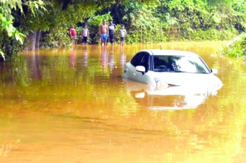
A weather-related red alert by the IMD was issued twice, in May and July 2021. The torrential rains that Goa experienced during the period from July 11 to 23, showed a peak of 133 mm on July 19, 2021. Consequent flooding inflicted heavy damage on habitations, livestock and vegetation, and untold miseries on the people of north Goa in particular. The high intensity cyclone in May 2021 had also induced heavy rains and widespread flooding, with significant impacts on the landscape. As such, Goa has now come under the firm grip of natural hazards in the form of successive cyclones with rain, and also abnormal monsoon rainfall with consequent flooding of lowlands, leading to annual disasters wherein man is largely to blame.
A flyby across the landscape of Goa shows that the coastline is intersected by dynamic estuarine river systems which cut across hinterland formations and wind their way towards the coast; these are tide dominated coastal plain estuaries. Up to the foothills of western Ghats, the coastal landscape comprises an intricate system of wetlands and lowlands, tidal marshes, cultivated paddy fields, intertidal beaches, all intersected by canals inland lakes, bays, lagoons and creeks. It is these low-lying geomorphic systems which have now become highly vulnerable to annual flooding whenever weather gets hostile. Inundations caused due to excessive rain constitutes the foremost natural hazard in Goa.

Even though total rainfall and distribution is variable in space and time, five major peaks with rainfall above 120 cm in 2019, 2020 and in June and July of 2021 were observed. Highest daily rain recorded earlier was 137 mm in 2020, 143 mm in 2019, and 120 mm to 140 mm during the years 2018 – 2014. In comparison, rainfall showed 23% surplus till July 25, 2021, 41% excess in 2020 and 33% excess in 2019. Rainfall long period average from June 01, 2021 to July 27, 2021 was an excess of 24% for north Goa, and 12% for south Goa. Such a scenario in June-July 2021 indicates that north Goa consistently received twice as much rainfall than the south (source: IMD). Interestingly, if the rainfall of last two years was in excess, why were inundations so severe only this year? Why were north Goa regions along the foothills of Western Ghats (as Usgao and Ganjem villages) most affected? In addition to extra/double the rain in north Goa in 2021, it is obvious that external factors were also at play. Incessant torrential rains in the highlands of Maharashtra certainly pushed over flowing water into Goa, a reason that compelled opening of dams in north Goa (also see report by Gonsalves, Herald). Such unusual release of flood waters resulted in an unbalanced distribution of waters and the subsequent haphazard runoff and abnormal stagnation in the lowlands.
The dispersal of excess flood waters and consequent overspill depends on four major factors: (1) Regional landform morphology and topography: Obviously, water flows from a higher to a lower level. It is well known that following torrential rains, a huge discharge of rain water gushes down the Ghats. The incline of catchment areas plays a twin role, to retain water by dense forests that adorn hill slopes, and to release excess water that accumulates in the low-lying wetlands and spill into existing rivers. (2) Natural gradients: Precursor slopes of the landscape govern the direction and rate of flow of flood water. Natural channels along hill slopes as well as flat regions are found in full spate during heavy rains. Unwarranted human interference along hilly terrains is responsible for deforestation leading to erosion, mud flows and abnormal mountain water discharge downslope. (3) Antecedent drainage patterns: An important regulator in the dispersal of flood waters is the pre-existing natural drainage network of yesteryears that determines the course and rate of outflow. All the wetlands of the world are characterised by inherent natural spillways through which surplus water gets discharged. The Ourem Creek and the ones at Guirim, Bastora, Nerul, Velsao, Cansaulim, Arossim, Colva, Varca are a few examples. (4) Role of wetlands and impacts of built-up areas: Low-lying khazans are the major geomorphic features which function as flood bays. However, the ever expanding townships have reclaimed and encroached on large expanses of marshlands. The water holding capacities of these wetlands is drastically reduced.
Inundation of wetlands is a recurring issue and submergence of houses is a major concern. Most dwellings do not have approvals, as town planning regulations do not permit constructions within the precincts of wetlands. Many of affected houses were in fact located on lowlands. Modern satellite images clearly reveal that dwellings have expanded manifold, reclaimed areas have increased and, as such, the wetlands have shrunk significantly. As such, if such houses get submerged, it is not due to flooding, but because these dwellings were built in dangerously vulnerable areas. Frenzied human actions in forests are responsible for deforestation. As such, occupying wetlands obviously puts humans in harm’s way.
Every time a natural phenomenon creates havoc, it is labeled as “natural disaster”. A common fallacy is that floods, cyclones and earthquakes are disasters. These are natural hazards, derived from events which are potentially destructive, and mostly end as tragedies if and when a community is afflicted. As reiterated before, natural elevation and protective vegetation are the only sites where the effects of natural hydro-meteorological hazards are nominal.
(Dr Antonio Mascarenhas is a former Scientist, NIO, Goa)