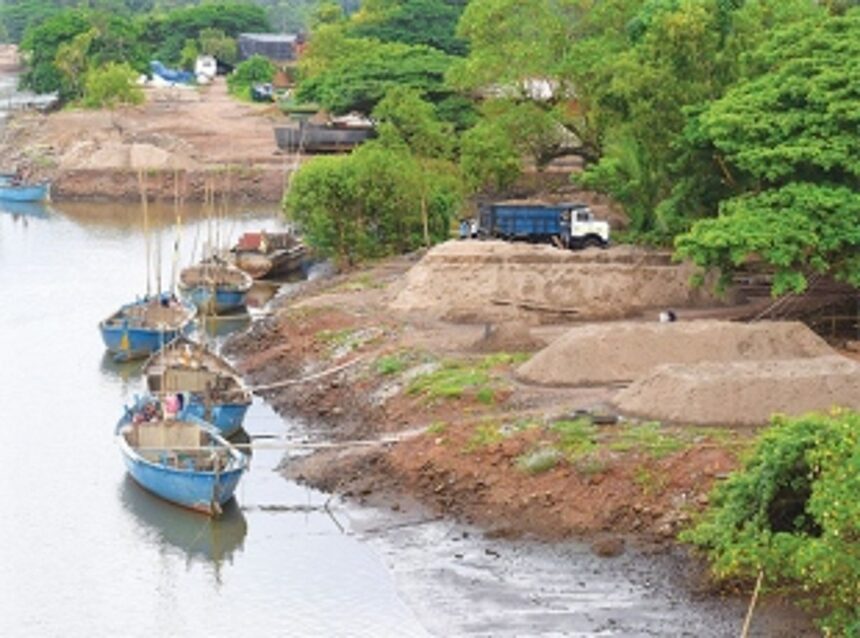
MARGAO: The Comprehensive District Survey Report on river sand mining in South Goa district recently revealed distressing environmental impacts in the Zuari River, including erosion, degradation, and saline intrusion.
Compiled with data from various government departments and the National Institute of Oceanography (NIO), the report underscores the urgent need for intervention to address cumulative impacts on the riverine and estuarine ecosystems.

“Impacts of sand mining have been deleterious and sustainability of sand mining is always difficult,” reads an extract of the report regarding the impact on the Zuari River.
According to the report, several geomorphological changes, such as erosion, midchannel/point bar deposition, disappearance of sandbar ripple marks, washout of old mining pits, and fresh mining pit signatures, have been observed. The downstream region witnessed significant riverbed degradation, along with other changes like bar thinning, lag removal, sediment accumulation, and exposure/burial of bedrocks.
Over the years, numerous pits and deep gorges have formed in various stretches of the river/estuary, the report noted. Lower estuary stretches face a higher salinity regime, contributing to damage to traditional embankments that protect adjacent areas.
Factors like land subsidence and sand/sediment removal from the riverbed further aggravate embankment damage. Salinity intrusion has altered land use, converting paddy fields, riparian zones, and mudflats into unproductive or mangrove areas.
The report presents crucial recommendations, emphasising adherence to sand extraction guidelines, depth restrictions, and the implementation of an “Environmental Conservation and Management Plan”. This plan outlines a team/committee responsible for executing and monitoring its aspects, with possible sub-teams and village committees as needed. The report divides the region into four zones based on geomorphology, sensitive areas, and numerical modelling.
Zone I, at the mouth region to Durbhat village jurisdiction, encompasses ecologically sensitive areas like mangroves, riverside urban zones and a bridge, requiring careful consideration due to potential impacts on shoreline, geo-morphology, and bird feeding grounds. Zone II, between Durbhat to Macasana, includes embankments, mangrove forests, and meandering areas, necessitating avoidance of meandering bends, mudflats, and mangroves due to their ecological significance.
Zone III, between Macasana and Curchorem, comprises meandering stretches and three bridges, requiring a 500-metre restriction on either side of the bridges. Zone IV, from Curchorem to the downstream region exhibits varying sediment thickness and riverbed changes.
The report also highlights seismic data observations near key regions like Borim Bridge, Ponchavadi-Chandor, and Sanvordem-Baag-Shirfod. These include significant riverbed aggradation, degradation, and changes in sediment thickness post-monsoon, illustrating the dynamic nature of the riverine environment.
The report underscores that unregulated sand extraction or extraction in sensitive areas, based on baseline data and prevailing site conditions, would negatively impact the environment. To mitigate these impacts, the report recommends adhering to minimum areas as per Sustainable Sand Mining and Management Guidelines (SSMG) 2016 and directives from the National Green Tribunal (NGT). Specific areas in the river stretches have been demarcated for sand extraction with imposed restrictions. Post-mining scenarios indicate bed level changes, ranging from -0.2 m to 0.5 m, as observed during monsoon (July-November 2020) and non-monsoon periods (November 2020 – June 2021).
In conclusion, the district survey stressed on the critical need for sustainable sand mining practices to preserve the delicate balance of the Zuari River ecosystem. “The sand extraction has to be conducted by traditional (manual) method only. No mechanised boats or machinery to be operated. The activity shall be restricted to the available areas only, and the depth of extraction should not exceed 3m from the existing baseline profile,” states the report.