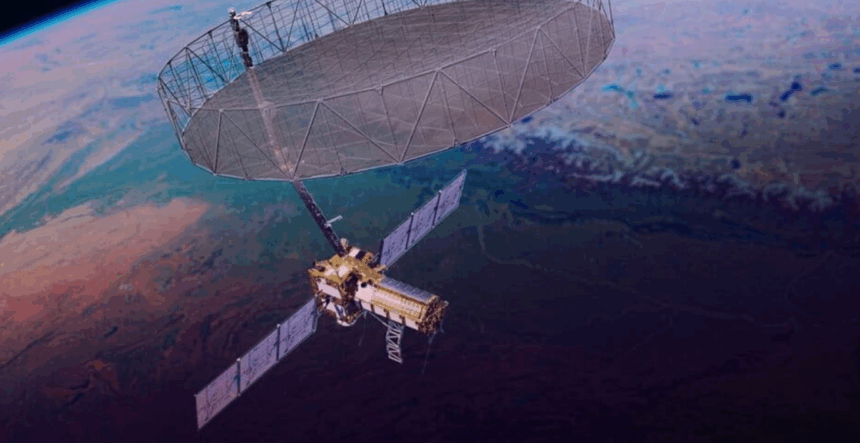
Scientists and disaster management experts are eagerly awaiting the first images of India’s forests and mountain ranges captured by NISAR (NASA-ISRO Synthetic Aperture Radar) — the joint Earth-observation mission between the Indian Space Research Organisation (ISRO) and NASA. The mission is expected to enter its science or operational phase in November, following the completion of its commissioning and calibration stages.
“NISAR’s calibration work is currently underway,” confirmed Chaitra Rao, NISAR Project Director and ISRO scientist, in an interview with Mongabay-India in Bengaluru. Calibration ensures that the satellite’s radar instruments record accurate measurements by comparing readings with known ground standards. To achieve this, scientists deploy trihedral corner reflectors at select ground locations, which reflect radar signals back to the satellite from various directions.

Rao noted that these reflectors are repositioned across different sites, with a special focus on the Indian Himalayas and forest regions, which are of high interest to researchers studying ecosystems, forest cover, and natural hazards.
Earlier, on September 25, NASA released the first radar images captured by NISAR over two locations in the United States. “These initial images are just a preview of the hard-hitting science that NISAR will produce,” said Nicky Fox, Associate Administrator at NASA’s Science Mission Directorate. The mission’s data, she added, will enable scientists to study Earth’s changing land and ice surfaces in unprecedented detail and aid global disaster-response and climate-monitoring efforts.
NISAR was launched on July 30, 2025, aboard ISRO’s GSLV-F16 from the Satish Dhawan Space Centre, Sriharikota. By mid-September, the satellite had entered its designated sun-synchronous polar orbit, which allows it to capture images of the same location under consistent lighting conditions. Notably, this was the first time a GSLV vehicle—typically used for geostationary missions—was employed to launch a spacecraft into a polar orbit.
Weighing 2,382 kilograms, NISAR is one of the heaviest Earth-observation satellites ever built, and its data will be made freely accessible under an open-access policy, announced by Union Minister of State for the Department of Space Dr. Jitendra Singh.
According to Singh, the open data from NISAR will be “a valuable resource for scientists in India and other developing nations, as well as disaster-response agencies and climate researchers worldwide.”
(This story is published from a syndicated feed)