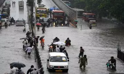
India is set to witness contrasting weather conditions over the coming week, with the southwest monsoon progressing steadily across southern and eastern regions even as severe heatwave conditions continue to grip large parts of northwest and central India, according to the India Meteorological Department (IMD).
The IMD on Sunday confirmed that the southwest monsoon has advanced further into parts of the southeast Arabian Sea, the Comorin region, southwest and southeast Bay of Bengal, most areas of the Andaman Sea, the entire Andaman & Nicobar Islands, and parts of the east-central Bay of Bengal.

Officials said conditions remain favourable for further advancement of the monsoon during the next three to four days. The weather office has also reiterated that the southwest monsoon is likely to make its onset over Kerala around May 26, with a model error margin of ±4 days.
Monsoon Progress So Far
| Region | Current Status |
|---|---|
| Andaman & Nicobar Islands | Monsoon fully active |
| Southeast Arabian Sea | Monsoon advanced |
| Bay of Bengal | Monsoon progressing |
| Kerala | Expected onset around May 26 |
| Northeast India | Increased rainfall activity expected |
While monsoon activity gains momentum in southern and eastern parts of the country, intense heatwave conditions are expected to continue over the plains of northwest and central India throughout the week.
The IMD has forecast heatwave conditions across Punjab, Haryana, Delhi, Madhya Pradesh, Vidarbha, Chhattisgarh, Telangana and parts of Maharashtra. Severe heatwave conditions are likely over West Uttar Pradesh between May 19 and 24 and over East Uttar Pradesh during May 19 and 20.
Warm night conditions are also expected in isolated areas of West Uttar Pradesh.
Regions Under Heatwave Alert
| State/Region | Forecast |
|---|---|
| West Uttar Pradesh | Severe heatwave (May 19–24) |
| East Uttar Pradesh | Severe heatwave (May 19–20) |
| Delhi & Haryana | Heatwave conditions |
| Madhya Pradesh | Heatwave likely |
| Telangana & Vidarbha | High temperatures expected |
| Maharashtra & Chhattisgarh | Heatwave alert |
On May 17, maximum temperatures remained between 40°C and 45°C across much of central India, adjoining north peninsular regions, Gujarat, Rajasthan and nearby Haryana. Banda in Uttar Pradesh recorded the country’s highest temperature at 46.4°C.
At the same time, widespread rainfall activity is forecast across several regions over the coming days.
The IMD has predicted isolated heavy to very heavy rainfall over northeast India, Andaman & Nicobar Islands and Sub-Himalayan West Bengal & Sikkim during the next six to seven days.
Southern states including Tamil Nadu, Puducherry, Kerala, Lakshadweep and south interior Karnataka are also likely to receive heavy rainfall during the next three days.
Heavy Rainfall Forecast
| Region | Rainfall Forecast |
|---|---|
| Northeast India | Heavy to very heavy rainfall |
| Kerala | Heavy rainfall likely |
| Tamil Nadu & Puducherry | Intense showers expected |
| Karnataka (South Interior) | Heavy rain alert |
| Sub-Himalayan Bengal & Sikkim | Very heavy rainfall possible |
During the 24 hours ending Sunday morning, heavy to very heavy rainfall was recorded in isolated places over Meghalaya and Sub-Himalayan West Bengal & Sikkim. Heavy rainfall was also reported from Arunachal Pradesh, Tripura, Konkan, Tamil Nadu, north interior Karnataka and Kerala.
Several regions witnessed thunderstorms accompanied by strong squally winds reaching speeds of 90–140 kmph. Such conditions were reported in Sub-Himalayan West Bengal, Nagaland, Manipur, Mizoram, Tripura and Karnataka.
| Weather Event | Details |
|---|---|
| Highest Temperature Recorded | Banda, Uttar Pradesh – 46.4°C |
| Wind Speed During Thunderstorms | 90–140 kmph |
| Monsoon Onset in Kerala | Likely around May 26 |
| Rainfall Duration in Northeast | Next 6–7 days |
| Heatwave Duration in UP | Till May 24 |
The IMD said multiple weather systems are influencing the current conditions, including a western disturbance over north Iran and adjoining regions, cyclonic circulations over northeast Uttar Pradesh, Bihar, Sub-Himalayan West Bengal and south coastal Andhra Pradesh, along with troughs extending across central and southern India.
The weather office has also advised fishermen not to venture into parts of the Bay of Bengal, Andaman Sea and Arabian Sea due to rough weather and strong winds expected over the coming days.
Warnings remain in place for the Gulf of Mannar, Comorin area, southwest and southeast Bay of Bengal, Andaman Sea, Lakshadweep region and along the Kerala and Karnataka coasts.