Team Herald
MARGAO: A group of villagers from Curtorim have formally requested a revision of the boundaries for the proposed Curtorim Biodiversity Heritage Site (BHS). They have suggested that the boundary be adjusted to align with the lake’s low waterline and exclude private wells and properties from the designated area.

Peter Dias, President of the Sirgem Add and Angodoi Tollem Tenants Association, along with Shubert Da Costa, President of the Curgunim Tenants Association, and Antonio F. Dias, President of the Tenants Associations of Vaingonode and Ralloi Tollem in Curtorim, and others have submitted their requests to the Goa State Biodiversity Board.
They have asked for the removal of all proposed water sport sites, eco-tourism sites, wetland ecosystems, and no-development slopes from the BHS map. Additionally, they have requested the omission of high tide lines and the correction of panchayat ward boundaries.
The group also emphasised that only the areas notified in the gazette on May 1, 2022, should be included in the BHS, and that the maps should be prepared on a scale of 1:4000.
Oswald Fernandes, a local resident, raised an objection to the inclusion of the Angdi Tollem paddy field and survey number 391/1-B in the BHS map, both located in Curtorim. Meanwhile, the President of the Comunidade of Curtorim pointed out that the Comunidade committee had not been consulted before any part of the Communidade land was included in the notified area.
Agnelo Azavedo also raised concerns, requesting the removal of all water sports and eco-tourism sites from the BHS, as well as the exclusion of wetland areas that are not relevant to the Curtorim BHS.
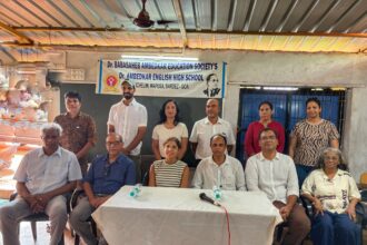
The villagers’ objections and suggestions are set to be discussed at a meeting scheduled for December 5 in Curtorim.
This meeting will provide a platform to address the concerns raised by those opposed to the current boundaries and proposals for the Curtorim Biodiversity Heritage Site.